Haeundae Beach (해운대해수욕장, Haeundae haesuyokjang) is the beach most people picture when they think of Busan: a long curve of pale sand, a row of towers behind it, and the open sea in front. For the middle of the beach, use Haeundae Station. If you want the Dongbaek Island walk first, use Dongbaek Station. For an evening view of Gwangan Bridge, head to the lighthouse viewpoint on Dongbaek Island at the west end of the beach. If this is your first trip to Korea, keep my Korea trip planner for first-timers open too.

Haeundae Beach from above on a clear day. Photo: Jin from Korea
Haeundae Beach at a Glance
| What | Quick answer |
|---|---|
| Beach | About 1.5 km of sand |
| Entry | Free, all year |
| Subway | Line 2: Haeundae or Dongbaek |
| Time needed | Half a day for the beach and island. The Dongbaek loop alone takes about 30–40 minutes. |
- Layout: Dongbaek Island and The Westin Josun sit at the western end; Mipo, where Haeundae Blueline Park starts, is at the eastern end.
- Swimming: Haeundae-gu sets the official season each year. Check current water-entry notices before you swim.
- Facilities: there is a tourist information center, restrooms, showers, changing rooms and paid parking.
Getting There: Haeundae Station or Dongbaek Station
Both stations are on Busan Metro Line 2, one stop apart. Use Haeundae Station for the center of the beach and Haeundae Market, or Dongbaek Station for the island and the west end.
Haeundae Station for the middle of the beach
For the main stretch of sand, get off at Haeundae Station (해운대역). Haeundae-gu says it is about an 8-minute walk from Exit 5, straight down toward the sea. Exit 3 is the side for Haeundae Market, which makes a good food stop before or after the beach; see my Haeundae Market street food guide.
Dongbaek Station for The Westin Josun end and Dongbaek Island
If you want the western end of the beach, near The Westin Josun and Dongbaek Island, use Dongbaek Station (동백역), one stop before Haeundae. From my own walks, it is the closer station for that end. The Nurimaru APEC House on the island also recommends Dongbaek Station, Exit 1. A nice plan is to arrive at Dongbaek, walk the island, then follow the sand east and leave from Haeundae Station.

The Haeundae Beach area, with The Westin Josun on the right. Photo: Jin from Korea
From the rest of Busan
From Seomyeon, Line 2 runs straight to both stations, and from Busan Station or Nampo you change from Line 1 to Line 2 at Seomyeon. Fares, transfers and exits are in my Busan subway guide, and a T-money card makes every ride easier. Express bus 1003 also stops at Haeundae Beach. Coming straight from the airport? See my Gimhae Airport to Haeundae guide. If you would rather take a taxi, check the route and estimated fare in Naver Map first, and remember that traffic around the beach can change both a lot; my Kakao T vs Uber guide explains how to book one.
The Promenade and the Pine Trees
A wide paved promenade runs along the back of the sand, and it is the nicest way to see the beach without getting sandy shoes. Pine trees line parts of it, which gives you shade on bright days and a softer frame for photos. SEA LIFE Busan Aquarium sits right by the main beach entrance, close to the tourist information center.
The paved promenade along the beach is flat. I like starting at the calmer Dongbaek Island end and walking toward the middle.

Haeundae Beach on a clear day. Photo: Jin from Korea
The Dongbaek Island Walk
Allow about 30–40 minutes for the Dongbaek Island loop at an adult walking pace. The roughly 1 km coastal path runs under black pines and includes steps and a short suspension bridge. Dongbaek Island (동백섬, Dongbaekseom) sits at the western end of the beach. It was once an island and is now joined to the mainland. The walk is free.
Highlights along the loop:
- Lighthouse and observation deck: a white lighthouse with a wide deck that looks out over the sea, Gwangan Bridge and the Oryukdo islets.
- Nurimaru APEC House: The venue for the 2005 APEC leaders’ meeting is free to visit. The building is open 9 am to 6 pm, with last admission at 5 pm, and closes on the first Monday of each month. See VisitKorea’s Nurimaru visitor information.
- Princess Hwangok statue and the Haeundae carved stone: a mermaid statue from a local legend, and the rock inscription that gave Haeundae its name.
From the beach, walk west toward The Westin Josun and follow the signs for the island path. If you want to go inside Nurimaru, allow time in addition to the loop and visit the building first. Afterward, continue to the outdoor lighthouse viewpoint for the bridge at dusk.
Day, Night and Rainy-Day Haeundae
Daytime
On a clear day the water turns deep blue. Outside summer there’s generally more room to walk the promenade, take photos or sit by the sea. In peak summer, come early if you want space.
Sunset and night
After dark, the towers behind the beach light up and the promenade stays lively well into the evening. The night view from the sand is my favorite version of Haeundae.

Haeundae Beach at night. Photo: Jin from Korea
In some seasons, the beach also hosts temporary light or art installations on the sand. They change from year to year, so treat them as a bonus if they happen to be there when you visit.

Art installations on Haeundae Beach at sunset. Photo: Jin from Korea
Rainy or foggy days
Do not write Haeundae off in bad weather. Sea fog can swallow the tops of the towers, and the empty, misty beach has its own moody charm. For a dry plan, the aquarium is right at the beach, and the covered Haeundae Market is a short walk away.
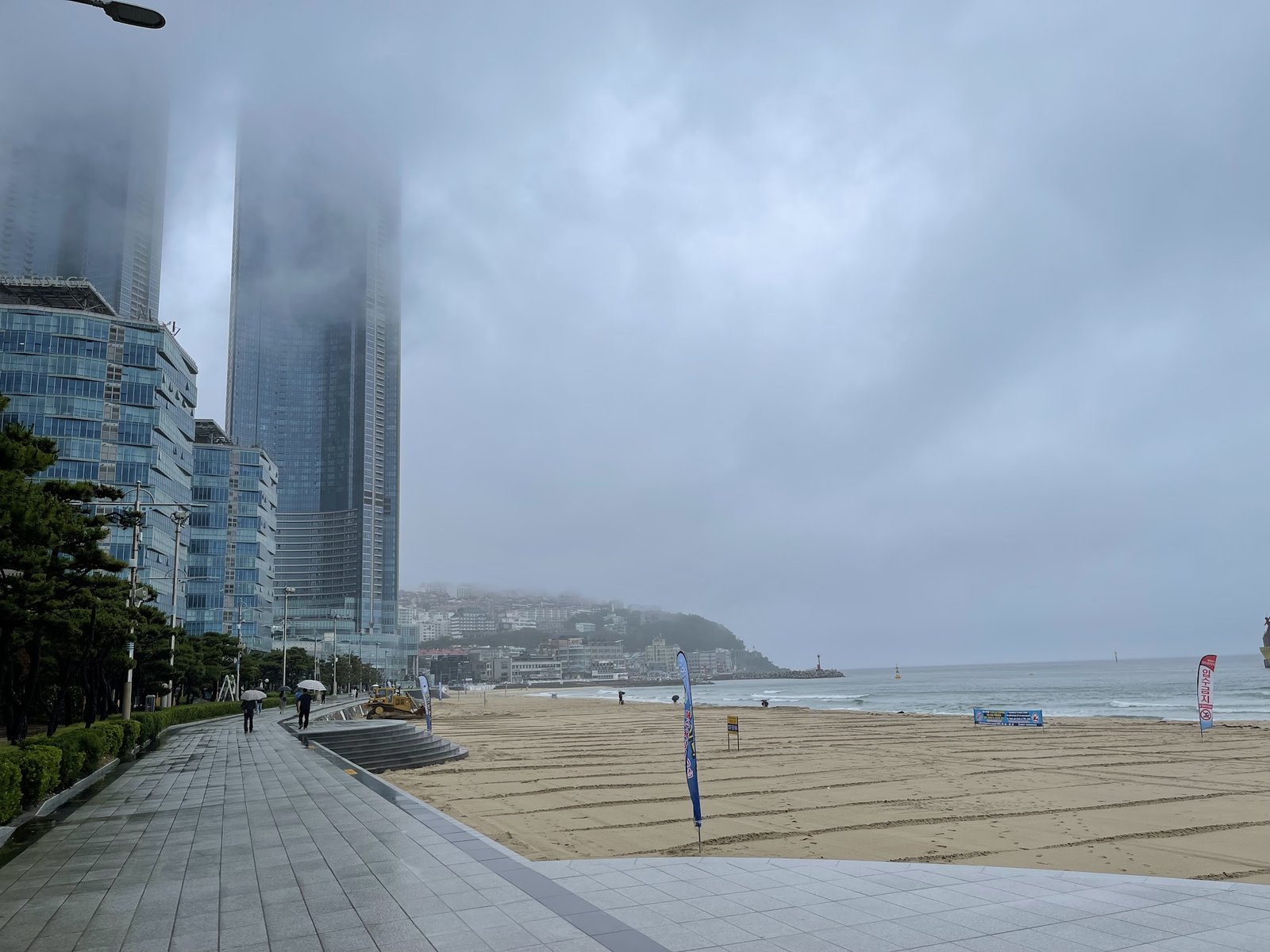
Haeundae Beach on a foggy, rainy day. Photo: Jin from Korea
Gwangan Bridge Night Views Nearby
Gwangan Bridge, the long suspension bridge across the bay, is lit up at night and is one of the classic Busan views. You do not need to go far from Haeundae to see it: the lighthouse deck and the area around Nurimaru on Dongbaek Island look straight across to it. For a closer view from the water, the Haeundae River Cruise heads out toward the bridge, and it looks best at sunset or after dark.

Gwangan Bridge at night. Photo: Jin from Korea
Can You See Japan? The Tsushima Bonus
Here is a local tip. On a very clear day, you can sometimes see Japan’s Tsushima Island as a faint gray outline on the horizon from the Busan coast around Haeundae. You cannot plan for it: most days are too hazy, and even on good days it is only a soft shape above the sea. But if you are on the beach or the island path on a crisp, clear day, look out to the southeast. If you spot it, you are looking at another country.
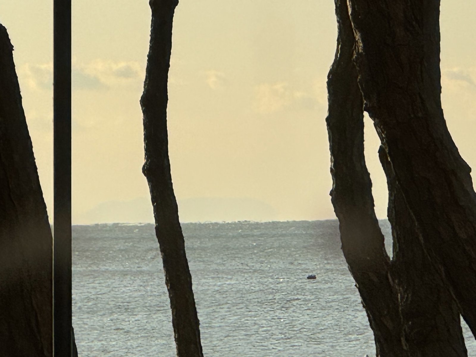
On a clear day, Tsushima Island can appear faintly on the horizon. Photo: Jin from Korea
Beach Season Basics
You can walk along Haeundae Beach year-round. Haeundae-gu announces the dates and hours of the supervised swimming season each year. During the season you can rent parasols, tubes and beach beds, and there are paid showers and lockers.
Outside the swimming season: On my October visit, I saw quite a few people swimming. Lifeguards may be off duty outside the official season. If you’re thinking of going in, check the posted water-entry restrictions and whether lifeguards are on duty first. Haeundae-gu prohibits entering the water from 30 minutes after sunset until 30 minutes before sunrise in the off-season. See the Haeundae-gu water-entry notice.
What to Do Nearby
- Haeundae Market: street food a few minutes from the beach; see my Haeundae Market guide.
- Haeundae Blueline Park: from Mipo at the eastern end of the beach, the Sky Capsule runs about 2 km along the coast to Cheongsapo, and the Beach Train continues to Songjeong. Tickets can sell out. See the official Blueline Park site for tickets.
- Songjeong Beach: a calmer surf beach further up the coast; see my Songjeong Beach guide.
- Osiria: For a separate outing from the beach, take Line 2 from Haeundae or Dongbaek Station to BEXCO Station, then transfer to the Donghae Line for Osiria Station. See the Busan Metro map. From Osiria Station, Lotte World Adventure Busan is roughly a 10-15 minute walk, and Skyline Luge Busan is around 20 minutes on foot. You can buy luge tickets on site or check the Skyline Luge Busan site.
- Where to stay: if you want to wake up by the sea, read my Paradise Hotel Busan review.
Practical Tips
- Use Naver Map: it shows station exits and walking routes; see my map apps comparison.
- Bring a layer: the sea wind can be strong outside summer, especially at night.
Beach entrances and viewpoints
Tap a link to open the place in Naver Map, or copy the Korean name into the search box.
- 해운대해수욕장 (Haeundae Beach) — Open in Naver Map
- 동백섬 (Dongbaek Island) — Open in Naver Map
- 해운대역 (Haeundae Station) — Open in Naver Map
- 동백역 (Dongbaek Station) — Open in Naver Map
New to Naver Map? See my Google Maps vs Naver Map vs KakaoMap guide.
Korean place names for the beach walk
Copy the Korean text into Naver Map or Papago, or show it on your phone.
Words
- 해수욕장 (haesuyokjang) — beach
- 등대 (deungdae) — lighthouse
- 화장실 (hwajangsil) — restroom
- 샤워장 (syawojang) — showers
- 파라솔 (parasol) — beach umbrella
Phrases
- 화장실 어디예요? (hwajangsil eodiyeyo?) — Where is the restroom?
- 동백섬은 어느 쪽이에요? (dongbaekseom-eun eoneu jjogieyo?) — Which way is Dongbaek Island?
- 해운대역은 어떻게 가요? (haeundae-yeogeun eotteoke gayo?) — How do I get to Haeundae Station?
- 사진 좀 찍어 주시겠어요? (sajin jom jjigeo jusigesseoyo?) — Could you take a photo for us?
- 파라솔 빌릴 수 있어요? (parasol billil su isseoyo?) — Can I rent a beach umbrella?
Plan the Rest of Your Trip
Haeundae is an easy first stop in Busan. For getting around, see my Busan subway guide, and for transport, money, apps and where to stay in one place, start with my Korea trip planner for first-timers. Enjoy the sea!
Leave a Reply